Cats and Trails and Garden Tales
Musings on cats, travel, gardens and life
All Dressed up for Fall
Awed by the beauty of the trees dressed in fall color at Gene Coulon Park….

Ten Random Words I Like
- Harmony – Different musical notes played or sung together at the same time with a pleasing sound or result. Also used metaphorically to describe how different things or persons blend or go well together. Living peaceably, or in harmony. I like harmony. Both kinds.
- Timbre – No, not timber. Timbre. As in the characteristic quality of a musical sound or voice. Let me say it for you while you visualize the word spelled correctly. Timbre. Can you hear it’s richness? Now picture the word timber and think of trees, stripped. Notice the difference.
- Luminescence – Light coming from a non heat source; like a glow worm which I have not seen or a firefly which I have. Or the sparks that fly when chewing a wintergreen lifesaver in total darkness deep inside the Lewis and Clark Caverns. I recommend you try it if you are ever in Montana, although other caverns may be substituted. (Please note that firefly and glow worms not found here.)
- Effervescent – Bubbly! Sparkly! Like the champagne that is sipped slowly after a wedding toast. Unfortunately this wonderful word has been hijacked by advertisers and applied to the cleansing action that occurs on stubborn denture stains when white tablets are dropped into water. We can do better than that. We must reclaim this word.
- Flora – A lovely word describing the plant life of a particular region or time. Much better than saying, ‘the plant life of a particular region or time.’ Almost always paired with fauna. See # 6.
- Fauna – The animal life of a particular region or time. I can never remember the meaning of fauna unless it’s paired with flora, and even then it’s a slow recall. Flora and Fauna, that’s how it should be. Not bad names for twins, either. (Tell them you got the idea here.)
- Ebb – To wane, or recede; a low condition, typically related to the tide. When paired with flow (see # 8) it becomes a far more hopeful and encouraging word.
- Flow – The opposite of ebb, the incoming phase of the tide. Waters rise and things are looking up! Ebb and Flow. But notice how ebb comes first.
- Flotsam – Marine debris from a shipwreck. I just like the sound of this word though I’m pretty sure I never used it before. Until now. It’s another one of those words that has a mate. Flotsam and jetsam. See #10 below for jetsam.
- Jetsam. Also marine debris from a vessel but with intention to lighten the load in distress. Turns out these have legal meaning in maritime law which I will not go into as I have no interest in salvaging any wreckage from the sea. Flotsam and Jetsam. They pair nicely but are probably not good names for twins, unless applied to a type of ‘fauna’ (e.g. bunny rabbits) similar to ”Flopsy, Mopsy, Cottontail, and Peter.”
What words do you like?
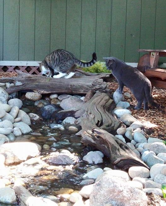
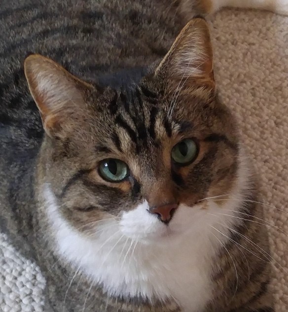
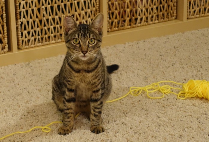
Tiger and Benji, Almost Brothers
This is Tiger and after much consideration and with some resignation, I have decided the new kit known as Benji shall be allowed to stay and share with me in my domain. Not equally of course but in part and only after maturity has been reached. Never let it be said I was unreasonable.

He still has much to learn (everything in fact) and if and when he settles down I shall be happy to teach him. In the meantime Sue promises to sequester him when I need to be left alone. She knows when that is. I shall try to be understanding but I have my dignity. I refuse to defend myself against that boy’s mischief.

And if we don’t exactly become friends perhaps we can still become brothers. Brothers may pester and brothers may fight but brothers will also understand and forgive. Maybe that is better after all.
From Tiger and Benji, almost but not quite, brothers.
Reflections on the Snohomish
A beautiful day for a walk along the Snohomish River….


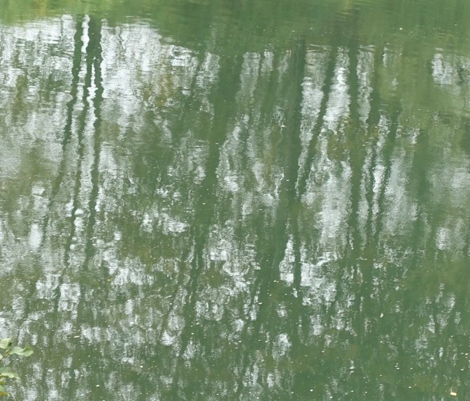
~ Susanne
Most Popular US National Park – Surprised?
I know you can google it but why don’t you guess? Of the 59 US National Parks, which one is the most popular based on number of annual visitors?
My guess was Yellowstone National Park. Established in 1872 and considered to be the world’s first national park, Yellowstone continues to impress visitors with bubbling mud pots, shooting geysers, and rainbow colored hot springs. Located in the northwest corner of Wyoming (with small portions in Idaho and Montana), it is a mountainous region where pristine rivers run with trout, and grizzly bear, bison, and moose roam among ponderosa pine and in expansive valleys. I’ve been there many times. Wish I was there now, in fact! But it’s not the most popular as measured by annual number of visitors.


My second guess was the Grand Canyon, knowing that people travel from around the world to see one of nature’s greatest vistas. I went there once too and it was grand indeed, though it doesn’t make my own favorites list. It’s too, I don’t know, grand. Inaccessible. But it comes in at #2 on the list of most visited National Parks for 2015.

How about Yosemite with its world famous valley and enormous chunks of solid granite, El Capitan and Half Dome. Can you top that?


Well apparently you can, because Yosemite shows up as #4 on the list according to numbers published by the National Park Service.
How about Olympic National Park one of my own local favorites?

Or Glacier National Park in Montana?

No and No. Okay then. Which National Park comes in at #1?
Unless you googled it I suspect you didn’t guess correctly (though I am a westerner and may be biased.)
The winner for most visited National Park in the USA is:
Great Smoky Mountains National Park with 10.7 million annual visitors!!
Surprised? I was.
I mean, aren’t the most gorgeous, jaw dropping sights in the US found in the west? Well, yes, I believe so. (See western bias mentioned above.)

Great Smoky Mountains straddles the border of Tennessee and North Carolina. The gentle, ancient mountains are covered with hardwood forests and filled with diverse plants and wildlife. Fog hangs over the region like a blue, hazy smoke giving the mountains their name, and the historic, rustic, cabins of settlers remain. It is a beautiful area and I liked it a lot. But #1? Grand Canyon which is #2 on the list isn’t even close, coming in at 5.5 million visitors. How can the number of visitors be almost double that of any others on the list? Inquiring minds want to know.
Here’s my theory. There are very few national parks on the eastern side of the country and Great Smoky Mountains NP is in close proximity to large population centers. It is therefore the “go to” park for millions. Yellowstone, on the other hand, is way out there, up in Wyoming which happens to be the least populous state in the union, and not on the way to anywhere. You have to really want to get there.
For the record here’s the official list of the 10 Most Visited National Parks for 2015 according to the National Park Service
- Great Smoky NP 10.712 million
- Grand Canyon NP 5.520 million
- Rocky Mountain NP 4.155 million
- Yosemite NP 4.150 million
- Yellowstone NP 4.097 million
- Zion NP 3.648 million
- Olympic NP 3.263 million
- Grand Teton NP 3.149 million
- Acadia NP 2.811 million
- Glacier NP 2.366 million
And here’s the list of my own current favorites:
- Yellowstone Perhaps you could tell?
- Olympic What can I say? I live in Washington State.
- Mt Rainier Practically in my backyard.
- Glacier Wish I had more time. Just go.
- Yosemite You saw the pictures.
- Zion Yosemite in color.
- Redwoods Perhaps the most beautiful trees in the world.
- Arches Red rock country!
- Great Smoky Surprised it was #1 but it really is gorgeous.
- Saguaro Love the cactus in the Arizona desert!
Finally, one more thing. If you include the 400 plus sites administered by the US National Park Service (parks, monuments, historic sites, parkways, etc.) guess what tops the most visited list? No need to google, I will give you the information right here, right now. At over 15 million visitors a year, it’s the 469 mile Blue Ridge Parkway which runs from North Carolina to Virginia and is right next to …. you guessed it, Great Smoky Mountains National Park.

As with the Smoky Mountains, it’s amazing to me that this is the most visited site in the National Park system. But I’m sticking to my earlier theory. This gorgeous parkway is in close proximity to major population centers of the east, accessible to millions and “on the way” to other places. We took the parkway once and I really did love it. If I made an expanded list that included all sites, it would definitely be near the top!
Of course this isn’t a competition and it doesn’t matter if your favorite parks ever show up on the Most Visited list. I expect my personal list will continue to change and grow as I visit new parks and revisit the old, as old memories fade and new ones are created. But I hope I have inspired you to go and see some of these national treasures. Visit as many as you can. Soon you’ll be making your own top 10 list and memories for a lifetime.
~ Susanne
Tiger woes
From the Tiger ~
I don’t mean to complain but I gotta tell you the new boy is getting on my nerves. I’m talking about the one they call Benji (aka, Squeaker and Stinker, Sue’s words, not mine.)
She must have known I was lonely ever since Shadow went away (may he rest in peace.) Yes, I do miss my brother. He was the greatest friend and confidante a cat could ever have. Always looking out for me. Always there for me to lean on.

And who can forget all the fun we had together exploring the great outdoors?
So a companion would be nice. But can this new kit on the block really take the place of Shadow?
The problem is, he never stops moving! Pestering! Stalking! Can’t he see I’m twice as big as he is? Only my hissing keeps him at bay and I don’t want to hiss everyday the rest of my life! It’s against my better nature. I’m gonna have to bop him one real soon because despite all my warnings he cannot seem to stay away from me. He’s always lurking somewhere ready to spring.
And get this. I found him sleeping on the big bed which is definitely against the rules! I’m gonna have to teach him a few things and the sooner the better!
From the Benji ~
I think he likes me.

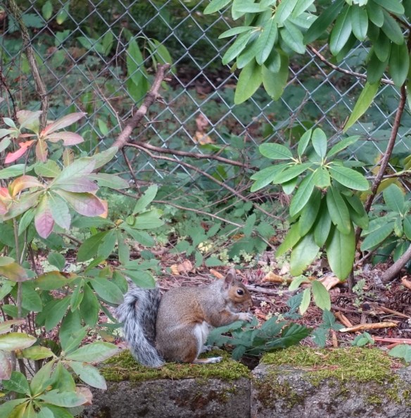
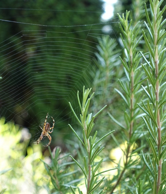
Surprise visitor to the Fall Garden
While strolling in my garden this fine day I came across an unexpected visitor..
It wasn’t this squirrel storing up supplies for the coming winter…
And it wasn’t this pair of kinglets who stopped by for a drink and bath.

It wasn’t Tiger who drank the flavored water after they left..
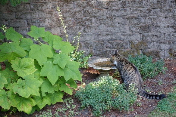
Nor this spider who made a home in the rosemary..
The turtle stands daily, stone cold on the stream’s edge, so it was not him.

No. It was in the woodpile.
Where I found the visitor hiding.

E.T.
How he got there I will never know. But I shall let him stay.
Some words I don’t use
LOL. No, don’t use it. I envy people who do. So convenient and concise. But it’s not for me. I tried it once and felt like an imposter. Haha, no problem. Heehee, occasionally. LOL? Lol? Never. There must be some deep seated emotional reason I can’t use it but I haven’t figured out yet what it is.
Bucket List. Nope. There are many things I want to do, plan to do, places I would like to go and plan to go. Good enough. I just can’t put it into the context of “before I kick the bucket.” Why spoil the dreams and all the fun of planning with that?
To die for. As in, “this cake is to die for!” Sigh. It may be really good cake. The best I have had in a long long time. But “to die for?” Um, no. I don’t think so. But again, I envy those who can say it with such passion. You do it well and it makes me want to try that cake! But I tried it once and it didn’t work out (the phrase not the cake.) That imposter thing again. So I would say it if I could but I can’t so I won’t.
Adamant. It’s a great word, actually. I said it once, a long time ago, just like this, “a DAM ant” where I thought it worked really well for emphasis. And my friend said, do you mean “ad-a-mant?” (spoken correctly rolling off the tongue, all in a hurry. ) Yes, I guess I did. But that was the last time for me. I don’t say adamant anymore. Too risky. Whatever. (Btw, I like “whatever.” “Whatever” works for me. So does “btw,” by the way.)
Dis. As in “disrespect” I guess, I was never quite sure. Seemed like everyone dissed someone else there for a while. Do they still do that? I can’t use words that seem to come out of nowhere and then disappear.
Toulees or tulies. As in “out in the.” Now I’m going way back. I was in grade school I think and had written a story about a girl who lived out in the “two leaves.” The spelling made perfect sense to me as that is how I pictured the word. But my sisters read the story and laughed out loud. (They actually DID laugh out loud, though there was no LOL in those days.) So I’m not taking a chance on that one again. Then again, no one says “out in the tulies” anymore, do they?
It’s hard to keep up. Do you have words like that?
~ Susanne
To Benji ~ from the Tiger
Tiger here. Solidarity, that’s what I’m talkin’ about little brother. These sniffles are for you (maybe even from you.) I bear them for your sake like the soldier that I am. I know what it’s like to be the new cat on the block. I came up from the streets just like you did (so to speak; let’s just say I know the inside of a jail.)
So Benji, I know you’re here. I hear your squeaks from the room below. I hear you flying through the house when you think I’m not around. (Careful boy, you still have lots to learn.) And I saw your paw stickin’ out today from under your cell. Ah, the quest for freedom! Don’t worry, it’s coming little brother. I can feel it in my whiskers.
But before we become a fully integrated household I need to let you know a few things.
First of all, Sue has confirmed to me that I shall remain the number 1 feline in this house. Yes, I’m Number 1 and that means you must needs be Number 2. Sorry, but you’ll get used to it. I did. My big brother Shadow (may he rest in peace) used to hold that most privileged status. (Don’t deny it Sue; you know it’s true.) I miss him, but now the title comes to me and I will set the standards for cat behavior in this home. See below.
Number 1 Entitlements
Full submission from #2 in all things, all matters and all disputes.
Exclusive rights to sleep on the big bed upstairs.
Exclusive rights to Sue’s office (includes blogging rights with picture.)
Exclusive rights to the bigger critters in back. (You’ll learn what that means later. Trust me on this.)
Full visiting privileges to your room with grandma.
In and out privileges at will.
Number 2 Responsibilities
Submission to #1 in all things, all matters and all disputes.
I think that should cover it.
Signing out for now till we meet in the flesh ~ the Tiger
A Tale of Two Kitties ~ the waiting continues
Glimpses through windows and sniffs under doors. The suspense builds as the promised meeting of the two kitties remains on hold. Our new Benji is living in quarantine while recovering from an upper respiratory infection. The highly contagious virus (to cats not humans) was not evident when we brought him home from the Humane Society but hit with a vengeance a couple of days later. A visit to our vet and we are half way through the antibiotics. The sneezing has decreased and I am thankful. I am keeping a close eye on Tiger for the least sign of infection.
I visit Benji downstairs a few times a day to bring him his favorite canned food, dispense medicine, clean his box and air out the room. (A real Florence Nightingale I am.) He’s always happy to see me, sparkly eyed and chipper.
During today’s visiting hours I plant myself in the comfy recliner to provide a lap for him and to watch the ballgame. I also bring my journal along to while away the time in case the inspiration to write strikes. Benji is usually content to sit quietly on my lap while I pet him. But today he is so distracted with the object in my hand that any writing is futile. It’s play time and he loves my bobbing pencil more than the lifeless toys on the floor. I put the journal away, bring out some yarn and Benji springs into action!
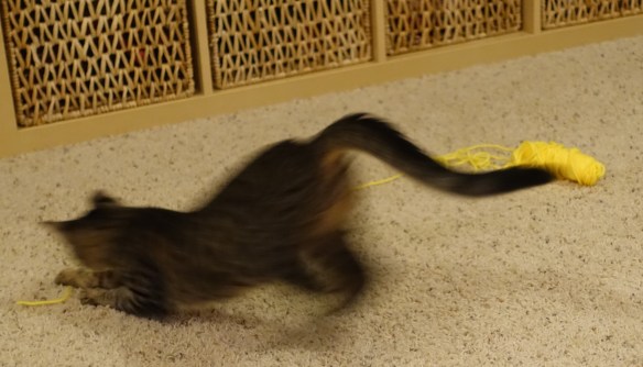
So it turns out he’s a kitten. A playful, active, if-anything-moves-I’m-on-it kitten. This becomes more apparent as he gets better each day and his energy level increases, surpassing any others in the house, feline or human.
When my visiting hour is up I sneak out of the room, wash up and head upstairs. By this time Tiger is peering through the sliding glass door outside wanting in. I oblige as I am wont to do. It’s my job to let him in and out at the time and place of his choosing. (Yes, they have my number.) After a quick snack of kibble he follows me up to my office. It’s our favorite place, quiet and peaceful. We visit awhile before he stretches out and I hear him snoring.
Maybe he’s dreaming of his new little brother? He saw him again yesterday through the large window in Benji’s room. I was visiting when we looked into the backyard and saw Tiger approach. He looked first at the little intruder and then at me with a look that said, ‘what are you doing in there?’ Hmm.. I can explain.

Everything I had read indicated that a slow introduction was important for cats. Well that is what we have ended up with, like it or not. I’m still hopeful that an enduring brotherhood and friendship will develop between these two kitties after the quarantine is over in a week or two. Time will tell.
~ Susanne
